Adding a Feature to an Existing Application: Google Caravan
My Role and Responsibilities
UX Designer
Research
Wireframing
Visual Design
Prototyping
Tools Used
Figma
Miro
Google Docs
Google Forms
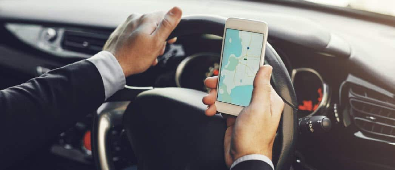
Context
DesignLab Capstone Project #2
July 2022
Context
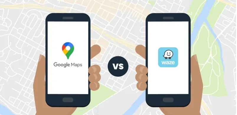
Google Maps: Dominating the Market
The Google Maps application has long been known as the golden standard in navigation, due to the fact that it provides high-quality, accurate directions. The application is easy to use and includes routes for public transportation, bikers, and walking. It offers additional features like traffic and weather alerts, multiple and alternative stops, route optimization, and location sharing as well. Google Maps also incorporates a quick locator for gas station grocery stores, and restaurants, and features local businesses. Due to the acquisition of its top competitor Waze in 2017, Google owns the vast majority of the navigation and mapping market share for everyday mobile and desktop users.
Problem
Despite the massive success and domination of the market share of the industry, there is room for improvement:
Waze and Google Maps are both Google-owned global mapping apps that are built for iPhones and Androids, but each platform has successfully maintained its own user base. Despite the fact that the apps both fall into the navigation category, they can easily be distinguished by users, and Waze still boasts a more social driving experience that some users prefer, with the platform being best known for its heavily crowd-sourced approach, as it uses community-driven information about road conditions from its users.
The Goal
As navigation apps strive to become better functionally and more social, there is less incentive to use multiple apps simultaneously. The opportunity also exists to consolidate local business reviews, weather updates, and communication from driver to driver.
While most navigation tools concentrate on individual driving, some social deficits in the current Google Maps user experience can be addressed by incorporating group travel into the ecosystem. I have proposed designing an original additional feature that will allow users to simultaneously:
share their location live
follow a friend in real-time
communicate with others
Empathize
During the discovery phase, it was necessary to conduct research in order to determine if the need exists for the creation and likelihood of adoption of the additional ‘follow-a-friend’ feature and, if so, what elements should (and should not) be included to integrate it seamlessly into the current user experience, based off of user feedback.
“I like to see...what people report. Real-time info is way better ...appreciated”
My Scope and Timeline
The scope of this project was to create a high-fidelity working prototype for a new feature within an existing mobile app, with all key user flows for the main functions of the app. I completed the brief as part of DesignLab’s course curriculum within a 4-week timeline.
Secondary Research
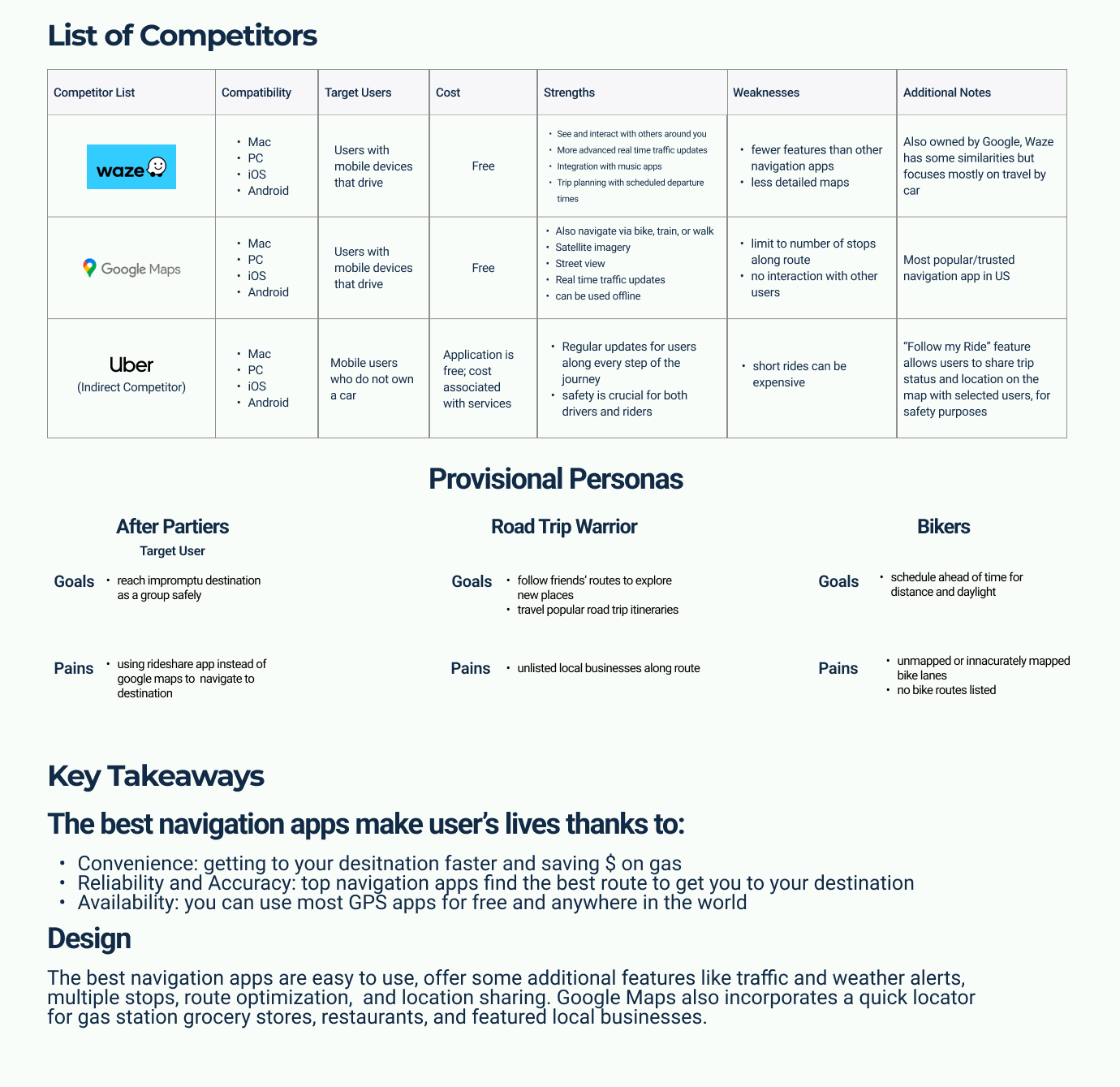
I conducted a market analysis to see what other digital products are potentially used for similar user needs. Secondary Research was performed on the as well as a Competitive Analysis of popular navigation app alternatives and features.
Target User
Determining the most relevant use cases helped to narrow down target user demographics. My original hypothesis included:
Long-distance drivers or those on road trips
Groups of friends or family on social outings
Bikers
User Interviews + Surveys
It was necessary to hear any relevant preferences and pain points surrounding the current Google Maps user experience, as well as surrounding other preferred navigational tools.
Traveling as a group in multiple vehicles
Utilizing navigation tools, even without a car (while biking, for example)
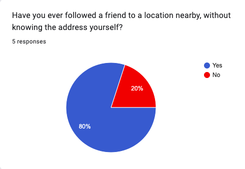
Following a friend in one vehicle to a location without knowing the address themselves (80%)
Relying on the environment for context if navigation/GPS was not available
Using location-sharing features functions like dropping a pin, to locate a friend (80%)
Often changing locations while out with a group (60%)
Going on a road trip as a group, taking multiple vehicles (60%)
“Waze is better for long distance. I can see police officers, road conditions, etc.”
Synthesizing
Responses were collected and consolidated in an empathy map. Common scenarios, or those experienced by the majority of participants included:
Creating Archetypes
Using the information collected from the 7 total participants (5 survey responders and 2 interviews), I was able to create 2 separate likely user personas. These became the target audience for the new feature.
The Roadtripper
The Social Butterfly
Analyze
The Planned Experience
Now that I had a clear idea of the target audience; their pain points and potential implicit needs, it was necessary to determine the best opportunity to integrate the feature into the existing interface and experience without detracting from the current one. The context of use was important to illustrate as Google Maps is designed for users on the go.
As the majority of the research participants had frequently traveled with friends and family on road trips in multiple vehicles, this was determined to be the most likely use case scenario.
This informed the inception of the feature name: Google Caravan
Design
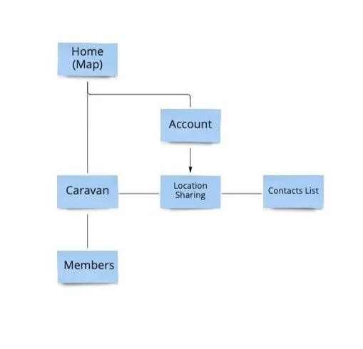
Information Architecture
For the feature to be functional, two types of users exist:
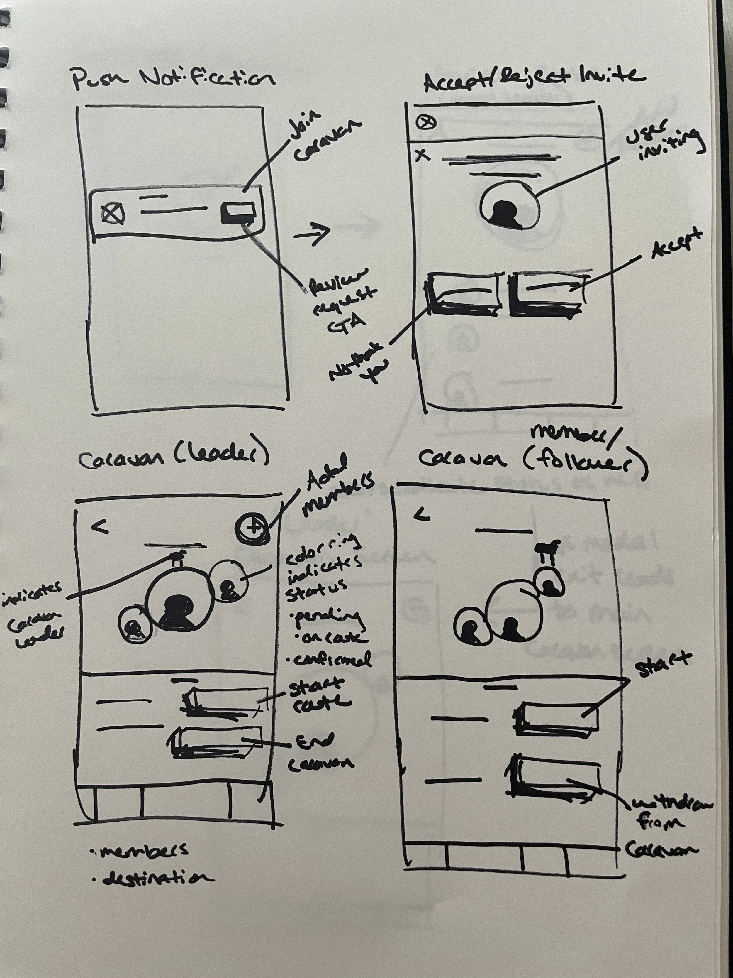
The “Leader” and “Followers / Members” will follow separate steps to form and travel as a Caravan. I created three main user flows to encapsulate the experience for both types of users, given the information collected from the interviews and surveys:
1. User forming the Caravan
2. Members joining the Caravan
3. Staying on route while driving together
As this is an additional feature, I did not create a full sitemap of the Google Maps app, just the minimum number of screens that would be necessary for Caravan.
Page Hierarchy
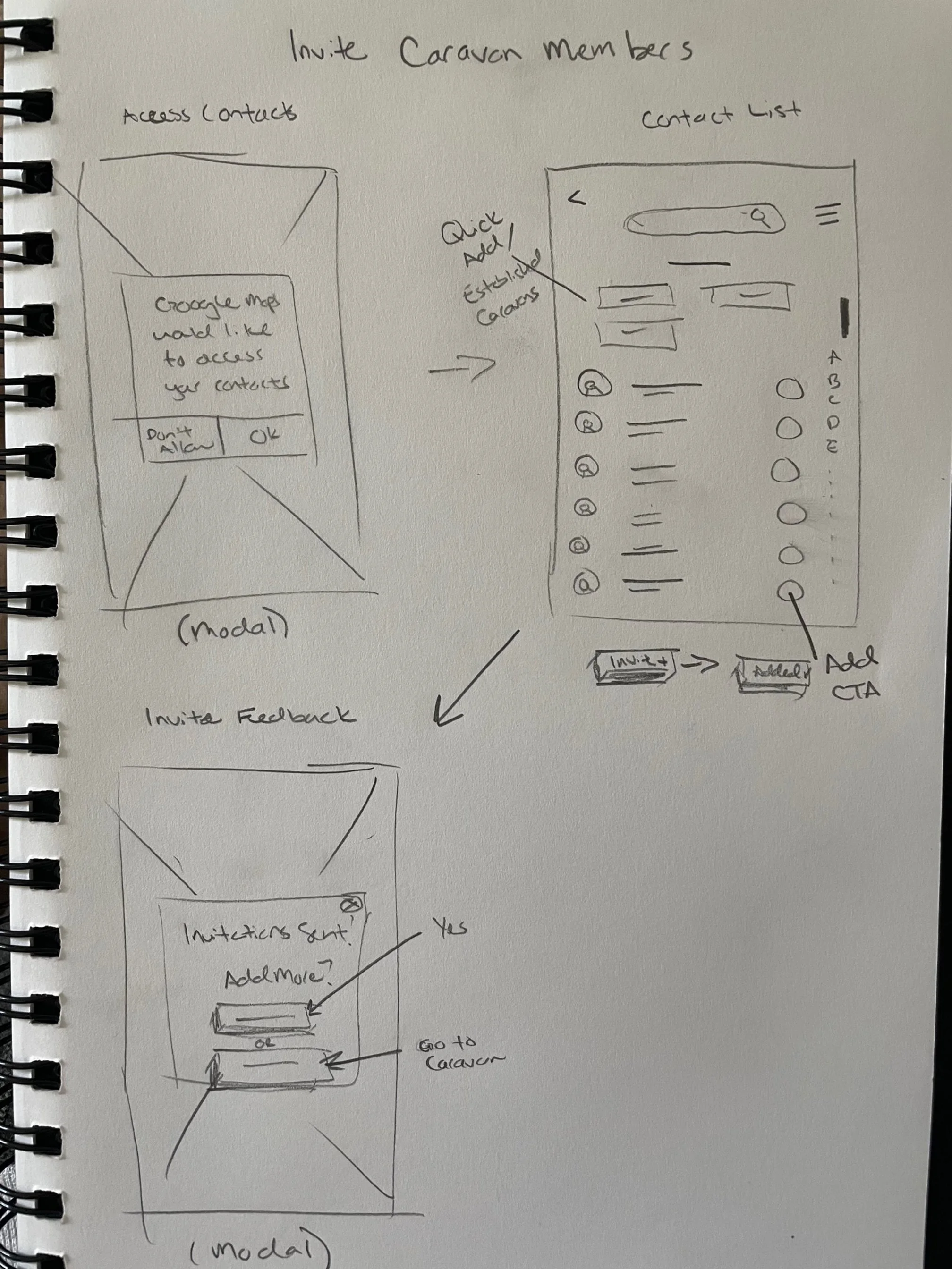
Initial Wireframe Sketches
The challenge when sitting down to sketch out the initial ideas for the feature was: to balance the design of the original screens whilst also clearly integrating the elements needed into the existing screens (such as the Home/Map Screens and Contacts list) without overcrowding or overwhelming the user.
As the majority (90%) of participants traveled in one or multiple vehicles on road trips, this was an ideal use case. I compiled a common range of traits and perspectives shared by those who shared their experiences while driving long distances as a group and selected Jessica to represent their needs.
I was surprised to find several survey responders and interviewees also often changed locations while out on the town (i.e. from restaurant to bar, etc.). When not utilizing ride-share options, this group often carpooled with a designated driver or two and followed one another to the next destination. Megan, with her active social life, was the perfect persona to represent their needs.
UI Elements
A full UI kit would not be necessary, as the visual elements for Google Maps already exist. I followed the Material Design Guidelines and aesthetic and style when creating the original icon and re-designing certain screens to incorporate the elements needed for the Caravan feature at a high level of fidelity.
Icon Design
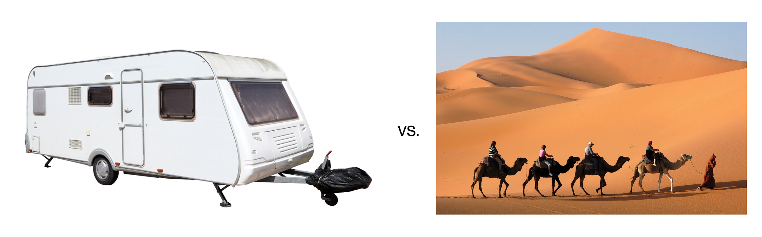
Inception of the idea for was based on my personal experience traveling with groups of friends every season to winter sport destinations. Lovingly termed “Caravan-ing up to the mountains” the word was already known to me, but I dove further into the definition:
Caravan:
(British): a vehicle equipped for living in, typically a trailer towed by a car and used when traveling for recreation.
(Historical): a group of people, especially traders or pilgrims, traveling together across a desert in Asia or North Africa.
In an effort to separate the feature from traditional modern cars - icons already familiar to navigation app users and incorporated into the Google Maps UI for different flows. I decided to pursue more original imagery and chose to research imagery associated with the historical definition., settling on the camel - a well-known symbol associated with caravans.
High Fidelity Screens
After running usability testing via zoom and sending the prototype to 3 additional users, observations were gathered and grouped together based on common feedback.
The main concerns included:
In a real-world scenario, groups of people traveling together often attempt to stay together for safety reasons. This was also supported by the survey results from our research participants. It was also confirmed by the testers that the ability to communicate between all parties was a top priority when theoretically using the feature.
Being able to tell if a member of the group was taking a rest break, getting gas, or needs assistance due to a breakdown were safety concerns that users wanted to be addressed.
As users were already used to seeing their distance and time from the destination, several wanted to have the same information re: the Caravan leader.
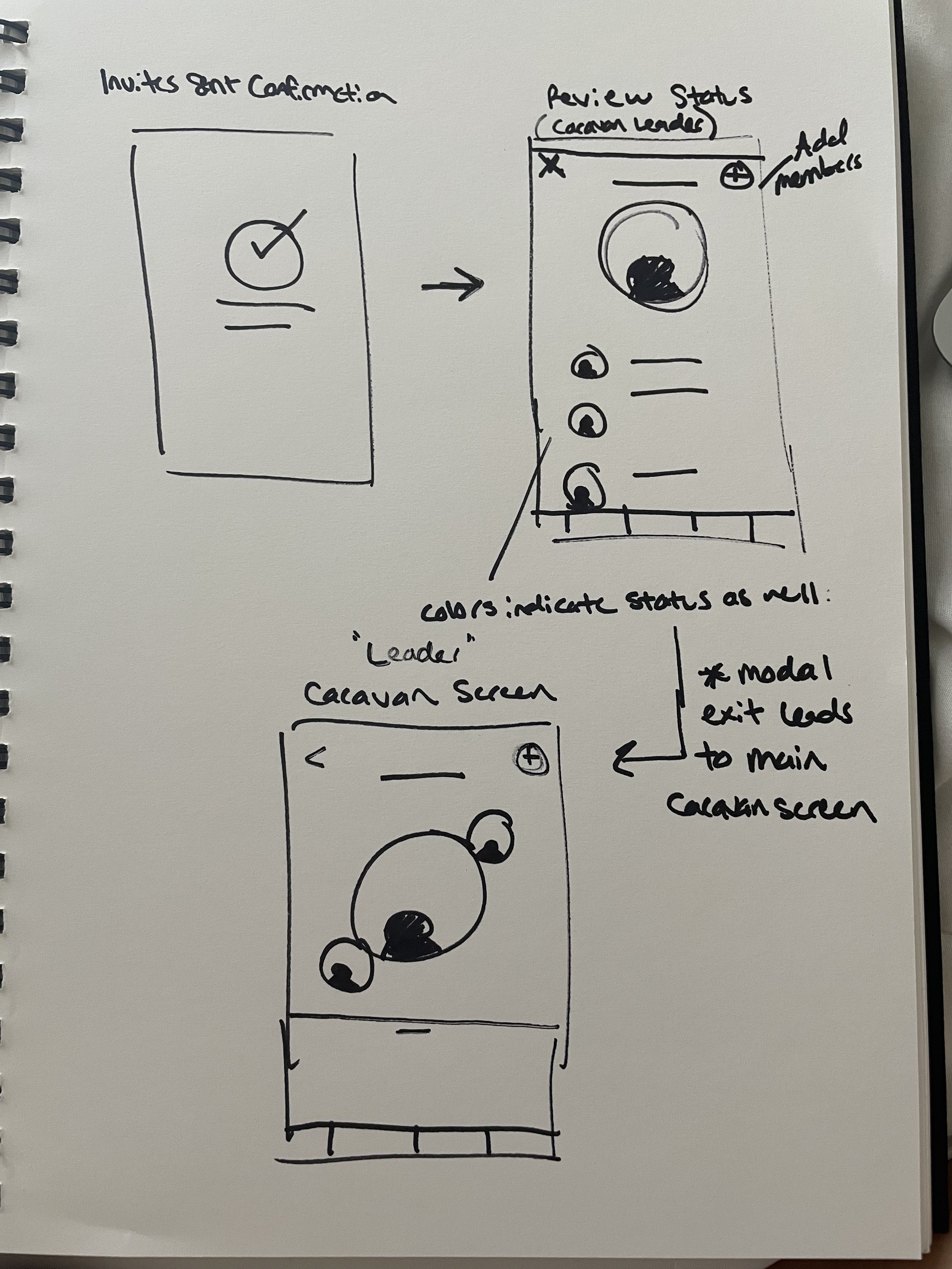
From the leader perspective, users reported being concerned they lost progress without visual feedback that the invites were sent, when directed back to the Home/Map screen
Testing
Affinity Map
Now knowing this, how might we…
Display Caravan member’s status to all members?
Integrate time and distance from the leader?
Indicate to the leader that Caravan members have confirmed?
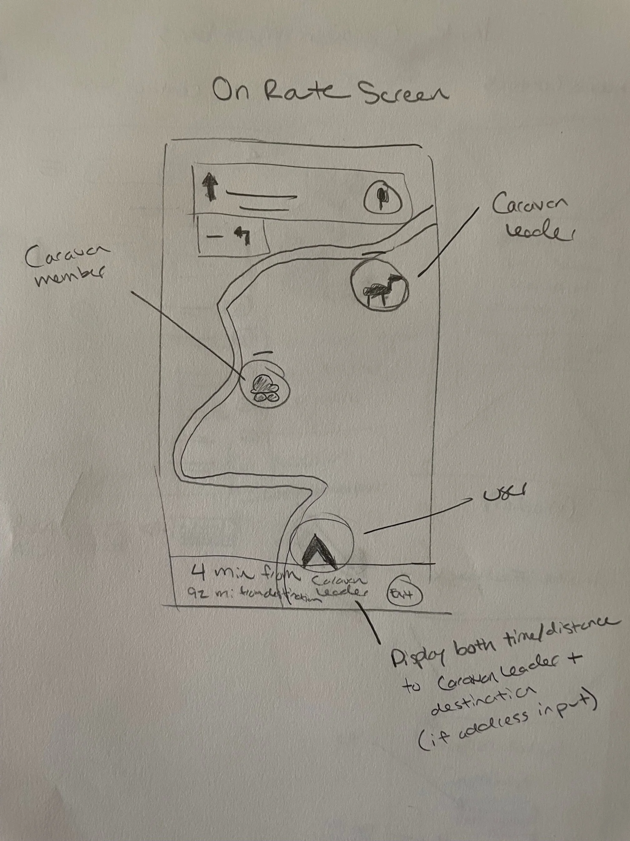
The Solution
After gathering and analyzing the feedback from the testing phase, adjustments were incorporated into the second iteration of the design:
Member Status: Attached existing Material Design icons to the user to indicate to the group why they are not on route. Icons are symbolic of breaks that may typically occur while on route. This reduces the need for a text or phone call.
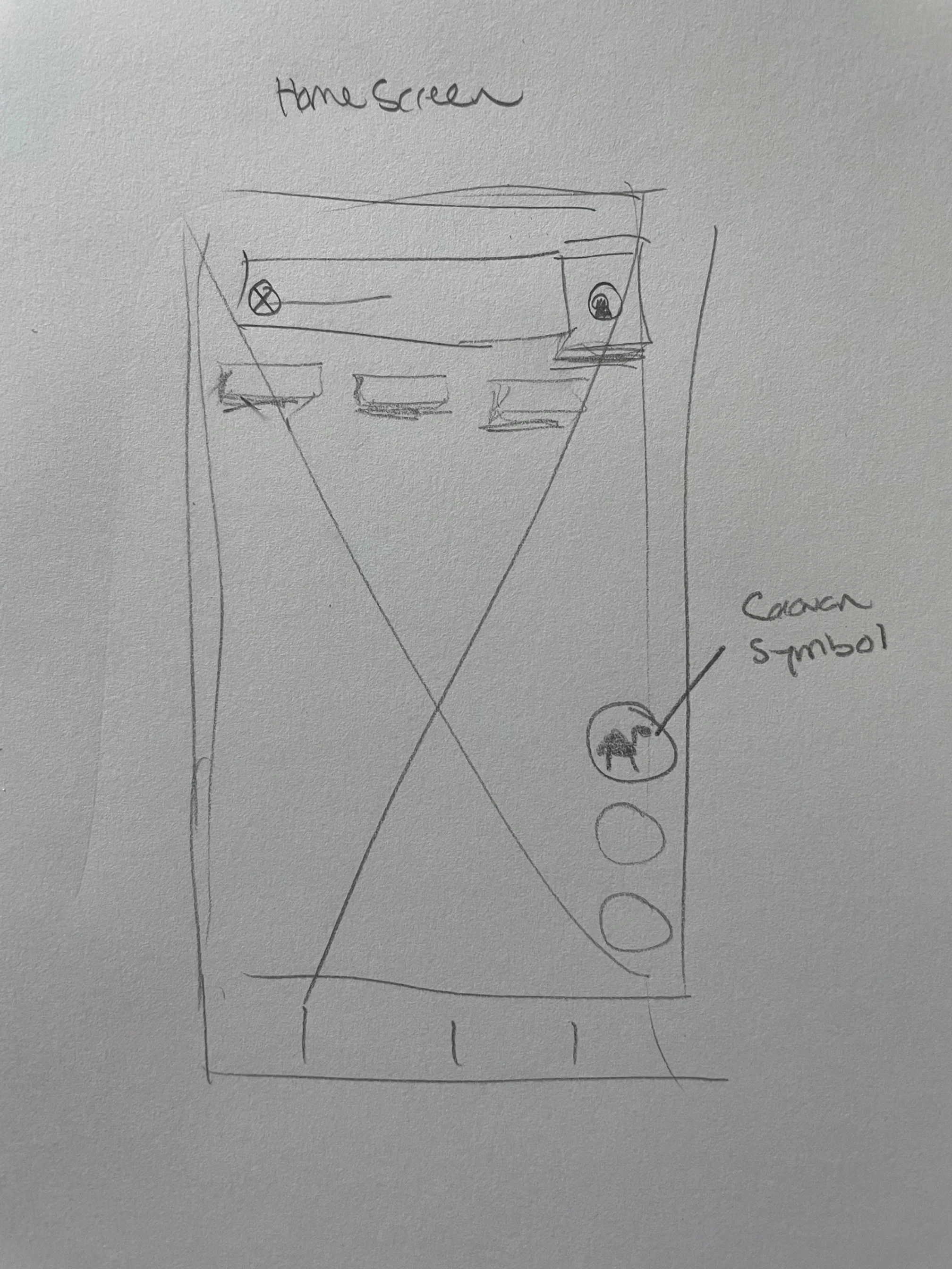
User Feedback: A number indicator has been added to the Caravan icon to show how many people are currently confirmed. The green color also shows that the Caravan is active
Time From Leader: For followers, the time from the leader will now be shown below the next step directions.
Next Steps
Continue usability testing to further iterate and improve the design
Explore additional potential features such as; in-app chat, fluid leader transitions once the journey has started for the group, and recommended or saved routes/itineraries that can be made public for other users to follow and enjoy